746 items
Laurent SALOMON / Naturimages
12LSL00102
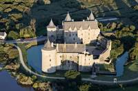
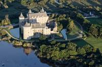
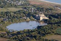
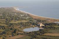
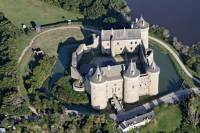
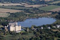
Aerial photo of Castle Suscinio on Presqu'ïle Rhuys [AT]
12LSL00101
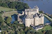
Aerial photo of Castle Suscinio on Presqu'ïle Rhuys [AT]
12LSL00100
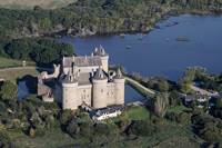
Aerial photo of Castle Suscinio on Presqu'ïle Rhuys [AT]
12LSL00099
Aerial photo of Castle Suscinio on Presqu'ïle Rhuys [AT]
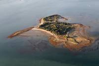
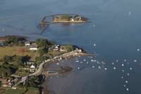
12LSL00098
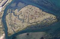
Aerial photo of Island Godec in the Gulf of Morbihan [AT]
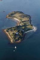
12LSL00097
Aerial photo of Island Govihan [AT]
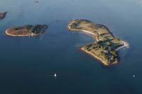
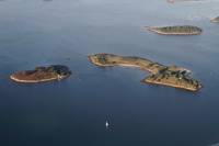
12LSL00096
Aerial photo of the Island and the Island Govihan Brannec in the Gulf of Morbihan [AT]
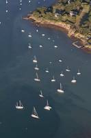
12LSL00095
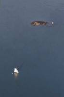
Aerial photo of yacht at anchor [AT]
12LSL00094
Aerial photo of Govihan Island, Isle of Brannec, Stibiden Island in the Gulf of Morbihan [AT]
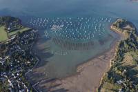
12LSL00093
Aerial photo of yachts at anchor in the cove of Kerner, Gulf of Morbihan [AT]
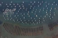
12LSL00092
Aerial photo of yachts at anchor in the cove of Kerner, Gulf of Morbihan [AT]
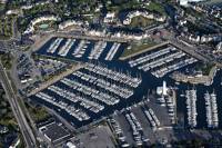
12LSL00091
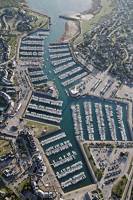
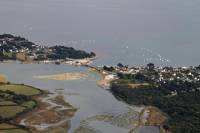
Aerial photo of the port of Crouesty Presqu'Île Rhuys [AT]
12LSL00090
Aerial photo of Port and Harbour Navalo Crouesty for the Kerpenhir Point [AT]
12LSL00089
Aerial photo of a traditional boat at the entrance of the Gulf of Morbihan [AT]
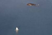
12LSL00088
Aerial photo of a traditional boat at the entrance of the Gulf of Morbihan [AT]
12LSL00087
Aerial photo of Port and Harbour Navalo Crouesty for the Kerpenhir Point [AT]
12LSL00086
Aerial photo of Islands near Larmor Baden [AT]
12LSL00085
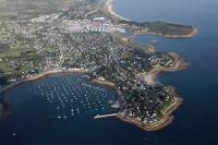
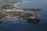
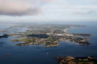
Aerial photo of Presqu'ïle Rhuys for the Kerpenhir Point, entrance to the Gulf of Morbihan [AT]
12LSL00084
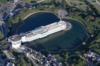
Aerial photo of the Thalasso center of the port of Crouesty [AT]
12LSL00083
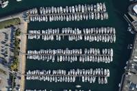
Aerial photo of the pleasure boats on the port of Crouesty Presqu'Île Rhuys [AT]
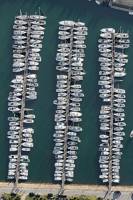
12LSL00082
Aerial photo of the pleasure boats on the port of Crouesty Presqu'Île Rhuys [AT]
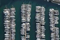
12LSL00081
Aerial photo of the pleasure boats on the port of Crouesty Presqu'Île Rhuys [AT]
12LSL00080
Aerial photo of the port of Crouesty Presqu'Île Rhuys [AT]
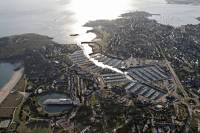
12LSL00079
Aerial photo of the port of Crouesty Presqu'Île Rhuys [AT]
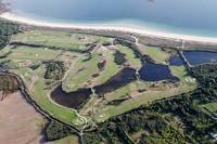
12LSL00078
Aerial photograph of Golf on Arzon Presqu'Île Rhuys [AT]
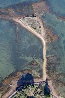
12LSL00077
Aerial photo of Island Point in the Gulf of Morbihan [AT]
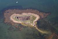
12LSL00076
Aerial photo Trohennec Island in the Gulf of Morbihan [AT]
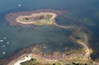
12LSL00075
Aerial photo Trohennec Island in the Gulf of Morbihan [AT]
12LSL00074
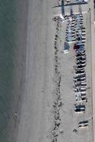
Aerial photo of dinghies sailing school of Roaliguen [AT]
12LSL00073
Aerial photo of Castle Suscinio [AT]
12LSL00072
Aerial photo of Castle Suscinio [AT]
12LSL00071
Aerial photo of Castle Suscinio [AT]
12LSL00070
Aerial photo of Castle Suscinio [AT]
12LSL00069
Aerial photo of marshes along the étier Sarzeau [AT]
12LSL00068
Aerial photo of marshes along the étier Sarzeau [AT]
12LSL00067
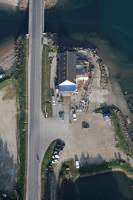
Aerial photo of the fishponds Bridge Banaster [AT]
12LSL00066
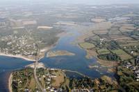
Aerial photo of the bridge and Banaster étier of Kerboulico [AT]
12LSL00065
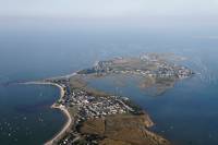
Aerial photograph of Pen Cadénic [AT]
12LSL00064
Aerial photo of the tip of Pénerf [AT]
12LSL00063
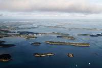
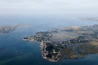
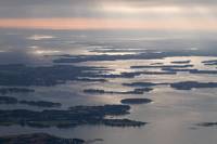
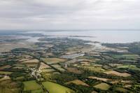
Aerial photo of the coastal Gulf of Morbihan [AT]
12LSL00062
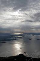
Aerial photo of the Morbihan Gulf and the island of Arz in stormy sky [AT]
12LSL00061
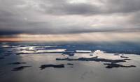
Aerial photo of the Gulf of Morbihan in stormy sky [AT]
12LSL00060
Aerial photo of the Gulf of Morbihan in stormy sky [AT]
12LSL00059
Aerial photo of the bridge and Banaster étier of Kerboulico [AT]
12LSL00058
Aerial photo of the bridge and Banaster étier of Kerboulico [AT]
12LSL00057
Aerial photo of the Rhuys peninsula and view to the estuary of the Vilaine [AT]
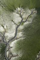
12LSL00056
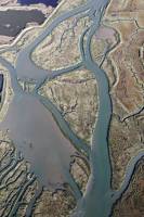
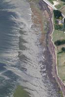
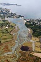
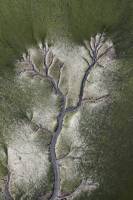
Aerial photo of tidal channels drawn in the mud [AT]
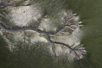
12LSL00055
Aerial photo of tidal channels drawn in the mud [AT]
12LSL00054
Aerial photo of tidal channels drawn in the mud [AT]
12LSL00053
Aerial photo of Passage and Quistinic island in the Gulf of Morbihan [AT]